


autour dent doche

scalpy
User
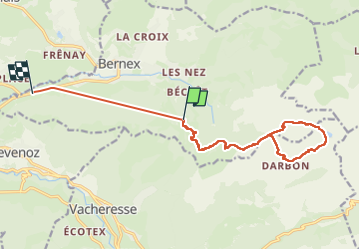

Length
16.5 km

Max alt
1965 m

Uphill gradient
1058 m
Km-Effort
32 km

Min alt
865 m

Downhill gradient
1526 m
Boucle
No
Creation date :
2025-06-09 09:43:04.147
Updated on :
2025-06-09 16:25:33.989
6h13
Difficulty : Medium

FREE GPS app for hiking
 SityTrail
IGN / Geographical institutes
SityTrail Plus
The world is yours!
About
Trail Walking of 16.5 km to be discovered at Auvergne-Rhône-Alpes, Upper Savoy, Bernex. This trail is proposed by scalpy.
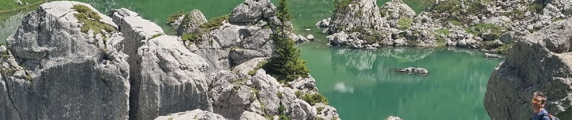
Photos


Positioning
Country:
France
Region :
Auvergne-Rhône-Alpes
Department/Province :
Upper Savoy
Municipality :
Bernex
Location:
Unknown
Start:(Dec)
Start:(UTM)
322823 ; 5135229 (32T) N.
Comments