


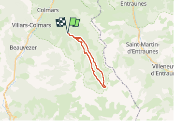
Les lacs de Lignin (Colmars 04)

Clo0413
User

Length
18.9 km

Max alt
2291 m

Uphill gradient
741 m
Km-Effort
29 km

Min alt
1641 m

Downhill gradient
731 m
Boucle
Yes
Creation date :
2025-06-09 06:42:32.437
Updated on :
2025-06-10 07:09:01.352
5h24
Difficulty : Medium

FREE GPS app for hiking
 SityTrail
IGN / Geographical institutes
SityTrail Plus
The world is yours!
About
Trail Walking of 18.9 km to be discovered at Provence-Alpes-Côte d'Azur, Alpes-de-Haute-Provence, Colmars. This trail is proposed by Clo0413.
Positioning
Country:
France
Region :
Provence-Alpes-Côte d'Azur
Department/Province :
Alpes-de-Haute-Provence
Municipality :
Colmars
Location:
Unknown
Start:(Dec)
Start:(UTM)
312506 ; 4892046 (32T) N.
Comments