


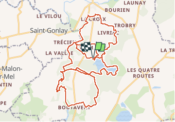
23.07.2015 - autour de Tremelin...

babeth35
User

Length
29 km

Max alt
121 m

Uphill gradient
375 m
Km-Effort
34 km

Min alt
41 m

Downhill gradient
374 m
Boucle
Yes
Creation date :
2015-07-23 00:00:00.0
Updated on :
2020-07-20 15:50:30.564
7h00
Difficulty : Difficult

FREE GPS app for hiking
 SityTrail
IGN / Geographical institutes
SityTrail Plus
The world is yours!
About
Trail Walking of 29 km to be discovered at Brittany, Ille-et-Vilaine, Iffendic. This trail is proposed by babeth35.
Positioning
Country:
France
Region :
Brittany
Department/Province :
Ille-et-Vilaine
Municipality :
Iffendic
Location:
Unknown
Start:(Dec)
Start:(UTM)
571935 ; 5327903 (30U) N.
Comments