


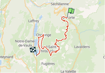
2025-06-01 Rando CVA La Morte vers Pierre-Châtel

holtzv
User GUIDE


5h52
Difficulty : Medium

FREE GPS app for hiking
 SityTrail
IGN / Geographical institutes
SityTrail Plus
The world is yours!
About
Trail Horseback riding of 29 km to be discovered at Auvergne-Rhône-Alpes, Isère, La Morte. This trail is proposed by holtzv.
Description
Rando CVA 2025 : De la Matheysine au Mt Aiguille
- km 0 : Faire le tour des Souillets pour l’échauffement des muscles et une très belle vue sur le Grand Serre
- km 6 : Passage sur la crête du Grand Serre
- km 10 : Passage au col du Parché à 2000m avec quelques restes de névés
- km 12.5 : Croix de Gouret
- km 15 : Pause déjeuner sur le site de la Chaud (St-Honoré 1500) à l’ombre
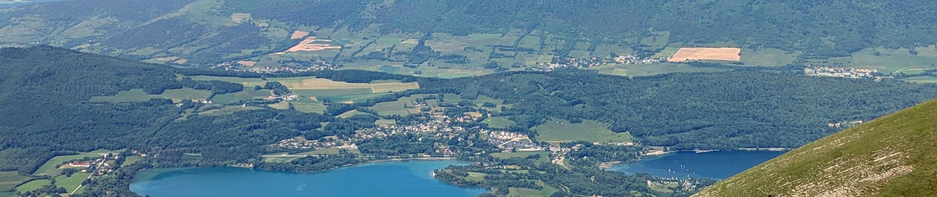
- km 25 : Passage à proximité du Grand Lac de Laffrey et du Lac de Pétichet
- km 28 : Passage au Lac de Pierre-Châtel
Photos


Positioning
Comments