


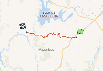
Santa Maria Olveirao

Vinceneux
User

Length
13.4 km

Max alt
477 m

Uphill gradient
231 m
Km-Effort
16.7 km

Min alt
256 m

Downhill gradient
288 m
Boucle
No
Creation date :
2025-06-11 05:10:15.811
Updated on :
2025-06-11 10:12:20.193
5h00
Difficulty : Difficult

FREE GPS app for hiking
 SityTrail
IGN / Geographical institutes
SityTrail Plus
The world is yours!
About
Trail Walking of 13.4 km to be discovered at Galicia, A Coruña, Mazaricos. This trail is proposed by Vinceneux.
Photos


Positioning
Country:
Spain
Region :
Galicia
Department/Province :
A Coruña
Municipality :
Mazaricos
Location:
Unknown
Start:(Dec)
Start:(UTM)
506693 ; 4756014 (29T) N.
Comments