


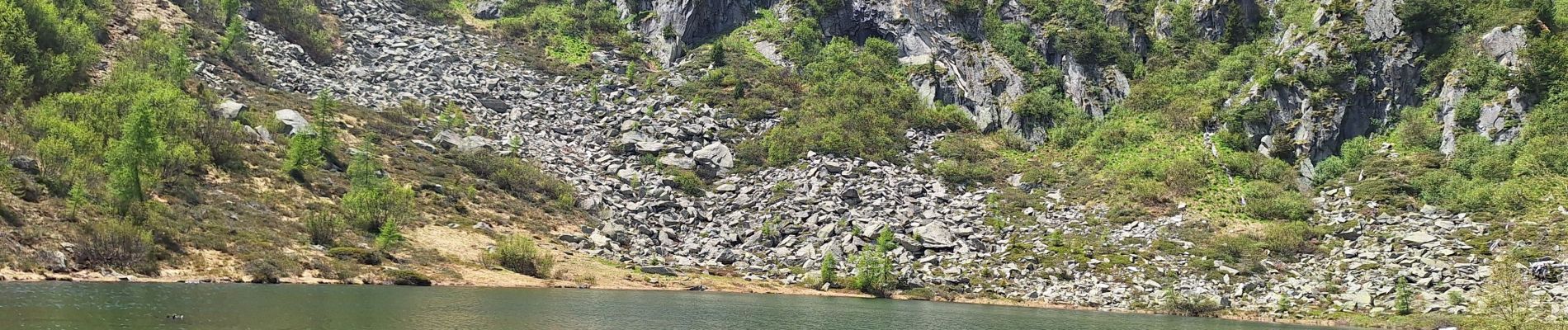
lago alto

lebretonjd
User
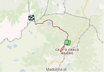

Length
6.7 km

Max alt
2179 m

Uphill gradient
471 m
Km-Effort
11.7 km

Min alt
1764 m

Downhill gradient
67 m
Boucle
No
Creation date :
2025-06-11 07:29:28.132
Updated on :
2025-06-11 18:44:28.47
2h30
Difficulty : Medium

FREE GPS app for hiking
 SityTrail
IGN / Geographical institutes
SityTrail Plus
The world is yours!
About
Trail Walking of 6.7 km to be discovered at Trentino-Alto Adige/Südtirol, Provincia di Trento, Pinzolo. This trail is proposed by lebretonjd.
Photos


Positioning
Country:
Italy
Region :
Trentino-Alto Adige/Südtirol
Department/Province :
Provincia di Trento
Municipality :
Pinzolo
Location:
Unknown
Start:(Dec)
Start:(UTM)
641531 ; 5122979 (32T) N.
Comments