


Lac de Bassia et granges de Campbieil

chasle
User
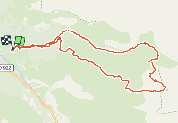

Length
14.4 km

Max alt
2282 m

Uphill gradient
1205 m
Km-Effort
30 km

Min alt
1193 m

Downhill gradient
1203 m
Boucle
Yes
Creation date :
2025-06-12 06:28:17.66
Updated on :
2025-06-12 16:26:03.916
6h55
Difficulty : Difficult

FREE GPS app for hiking
 SityTrail
IGN / Geographical institutes
SityTrail Plus
The world is yours!
About
Trail Walking of 14.4 km to be discovered at Occitania, Hautespyrenees, Gavarnie-Gèdre. This trail is proposed by chasle.
Positioning
Country:
France
Region :
Occitania
Department/Province :
Hautespyrenees
Municipality :
Gavarnie-Gèdre
Location:
Gèdre
Start:(Dec)
Start:(UTM)
257432 ; 4741101 (31T) N.
Comments