


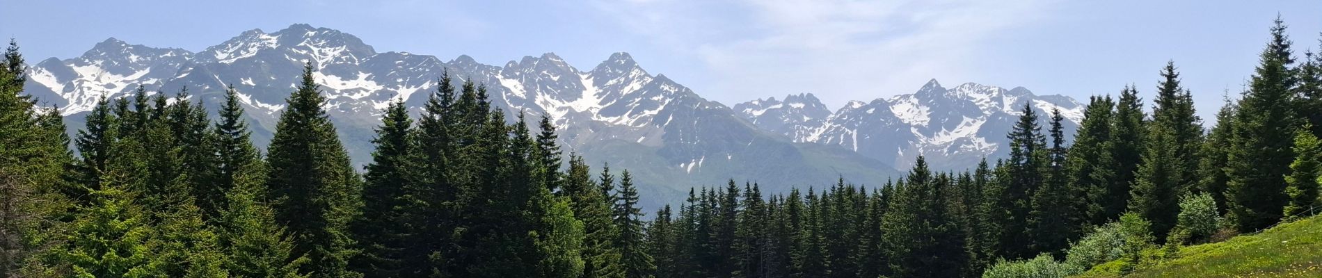
LE GRAND ROCHER PAR LE REFUGE DU CRET DU POULET

walrou63
User
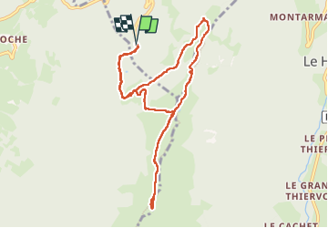

Length
10.5 km

Max alt
1915 m

Uphill gradient
496 m
Km-Effort
17.1 km

Min alt
1426 m

Downhill gradient
495 m
Boucle
Yes
Creation date :
2025-06-12 08:11:01.616
Updated on :
2025-06-13 08:18:57.226
3h10
Difficulty : Difficult

FREE GPS app for hiking
 SityTrail
IGN / Geographical institutes
SityTrail Plus
The world is yours!
About
Trail Walking of 10.5 km to be discovered at Auvergne-Rhône-Alpes, Isère, Crêts-en-Belledonne. This trail is proposed by walrou63.
Photos


31 photos in total. Please click on a photo to see them all in the gallery.
Positioning
Country:
France
Region :
Auvergne-Rhône-Alpes
Department/Province :
Isère
Municipality :
Crêts-en-Belledonne
Location:
Saint-Pierre-d'Allevard
Start:(Dec)
Start:(UTM)
268573 ; 5023333 (32T) N.
Comments