


Trek Ubaye J2

loicthev
User
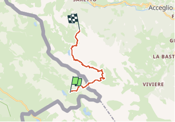

Length
9.5 km

Max alt
2748 m

Uphill gradient
658 m
Km-Effort
19.7 km

Min alt
2041 m

Downhill gradient
1096 m
Boucle
No
Creation date :
2025-06-13 10:19:37.754
Updated on :
2025-06-13 19:59:58.323
3h29
Difficulty : Difficult

FREE GPS app for hiking
 SityTrail
IGN / Geographical institutes
SityTrail Plus
The world is yours!
About
Trail Walking of 9.5 km to be discovered at Provence-Alpes-Côte d'Azur, Alpes-de-Haute-Provence, Val-d'Oronaye. This trail is proposed by loicthev.
Description
trek ubaye jour 2
Lac de l'orrenaye > Chiaperra
13/06/2025
Alexandre
Positioning
Country:
France
Region :
Provence-Alpes-Côte d'Azur
Department/Province :
Alpes-de-Haute-Provence
Municipality :
Val-d'Oronaye
Location:
Larche
Start:(Dec)
Start:(UTM)
334989 ; 4921937 (32T) N.
Comments