


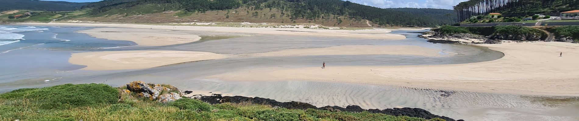
Fisterra Lires

Vinceneux
User
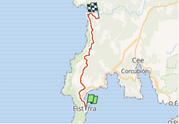

Length
16.6 km

Max alt
142 m

Uphill gradient
395 m
Km-Effort
22 km

Min alt
0 m

Downhill gradient
371 m
Boucle
No
Creation date :
2025-06-14 05:46:57.816
Updated on :
2025-06-14 16:58:12.309
4h37
Difficulty : Very difficult

FREE GPS app for hiking
 SityTrail
IGN / Geographical institutes
SityTrail Plus
The world is yours!
About
Trail Walking of 16.6 km to be discovered at Galicia, A Coruña, Fisterra. This trail is proposed by Vinceneux.
Photos


Positioning
Country:
Spain
Region :
Galicia
Department/Province :
A Coruña
Municipality :
Fisterra
Location:
Unknown
Start:(Dec)
Start:(UTM)
478561 ; 4750235 (29T) N.
Comments