


SityTrail - AF. Le vallon de la Culasse

cb8310
User
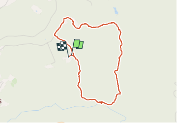

Length
4.4 km

Max alt
249 m

Uphill gradient
137 m
Km-Effort
6.3 km

Min alt
115 m

Downhill gradient
135 m
Boucle
Yes
Creation date :
2025-06-15 04:33:47.355
Updated on :
2025-06-15 04:34:10.374
1h25
Difficulty : Medium

FREE GPS app for hiking
 SityTrail
IGN / Geographical institutes
SityTrail Plus
The world is yours!
About
Trail Walking of 4.4 km to be discovered at Provence-Alpes-Côte d'Azur, Var, Bagnols-en-Forêt. This trail is proposed by cb8310.
Positioning
Country:
France
Region :
Provence-Alpes-Côte d'Azur
Department/Province :
Var
Municipality :
Bagnols-en-Forêt
Location:
Unknown
Start:(Dec)
Start:(UTM)
316440 ; 4822686 (32T) N.
Comments