


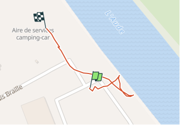
Limoux

papajp
User

Length
166 m

Max alt
167 m

Uphill gradient
0 m
Km-Effort
166 m

Min alt
166 m

Downhill gradient
0 m
Boucle
No
Creation date :
2025-06-15 12:43:31.0
Updated on :
2025-06-15 12:49:51.115
6m
Difficulty : Unknown

FREE GPS app for hiking
 SityTrail
IGN / Geographical institutes
SityTrail Plus
The world is yours!
About
Trail Walking of 166 m to be discovered at Occitania, Aude, Limoux. This trail is proposed by papajp.
Photos

Positioning
Country:
France
Region :
Occitania
Department/Province :
Aude
Municipality :
Limoux
Location:
Unknown
Start:(Dec)
Start:(UTM)
436110 ; 4767471 (31T) N.
Comments