


Round top et lac spruce

wawadefrance
User
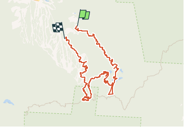

Length
11.6 km

Max alt
950 m

Uphill gradient
666 m
Km-Effort
20 km

Min alt
504 m

Downhill gradient
630 m
Boucle
No
Creation date :
2025-06-15 16:13:45.373
Updated on :
2025-06-15 19:10:57.827
2h56
Difficulty : Very difficult

FREE GPS app for hiking
 SityTrail
IGN / Geographical institutes
SityTrail Plus
The world is yours!
About
Trail Walking of 11.6 km to be discovered at Quebec, Brome-Missisquoi, Sutton. This trail is proposed by wawadefrance.
Positioning
Country:
Canada
Region :
Quebec
Department/Province :
Brome-Missisquoi
Municipality :
Sutton
Location:
Unknown
Start:(Dec)
Start:(UTM)
692848 ; 4996841 (18T) N.
Comments