


les canalettes depuis Nant

gadafo
User
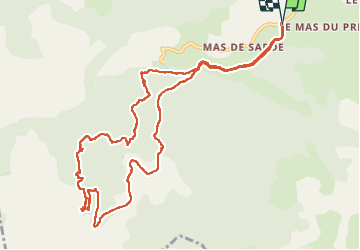

Length
13.2 km

Max alt
738 m

Uphill gradient
327 m
Km-Effort
17.6 km

Min alt
513 m

Downhill gradient
327 m
Boucle
Yes
Creation date :
2025-06-17 07:41:29.19
Updated on :
2025-06-21 07:37:06.27
4h00
Difficulty : Difficult

FREE GPS app for hiking
 SityTrail
IGN / Geographical institutes
SityTrail Plus
The world is yours!
About
Trail Walking of 13.2 km to be discovered at Occitania, Aveyron, Nant. This trail is proposed by gadafo.
Positioning
Country:
France
Region :
Occitania
Department/Province :
Aveyron
Municipality :
Nant
Location:
Unknown
Start:(Dec)
Start:(UTM)
522891 ; 4871589 (31T) N.
Comments