


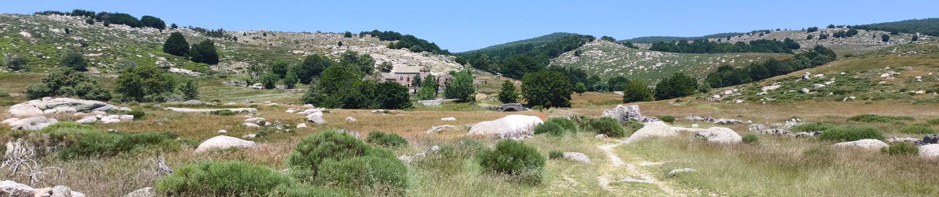
Masmejean Pont du Tarn

tyntyn
User
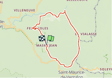

Length
17 km

Max alt
1373 m

Uphill gradient
462 m
Km-Effort
23 km

Min alt
1035 m

Downhill gradient
462 m
Boucle
Yes
Creation date :
2025-06-17 06:58:50.661
Updated on :
2025-06-17 13:36:01.942
6h02
Difficulty : Medium

FREE GPS app for hiking
 SityTrail
IGN / Geographical institutes
SityTrail Plus
The world is yours!
About
Trail Walking of 17 km to be discovered at Occitania, Lozère, Pont de Montvert - Sud Mont Lozère. This trail is proposed by tyntyn.
Photos


Positioning
Country:
France
Region :
Occitania
Department/Province :
Lozère
Municipality :
Pont de Montvert - Sud Mont Lozère
Location:
Saint-Maurice-de-Ventalon
Start:(Dec)
Start:(UTM)
563932 ; 4910652 (31T) N.
Comments