


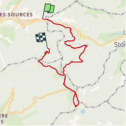
Col de Bussang - Rouge Gazon - Séchenat

VacheKiri67
User


6h00
Difficulty : Difficult

FREE GPS app for hiking
 SityTrail
IGN / Geographical institutes
SityTrail Plus
The world is yours!
About
Trail Walking of 15 km to be discovered at Grand Est, Vosges, Bussang. This trail is proposed by VacheKiri67.
Description
Faite le 15/07/2015 avec notre fils de 10 ans. Enregistrement partiel. D'après : Guide Frank Vosges - N°31 Col de Bussang - Rouge Gazon - Séchenat. La durée indiquée pour le circuit est de 5h. Nous avons complété ce parcours avec la montée au sommet de la Tête des Perches.
Photos


Positioning
Comments
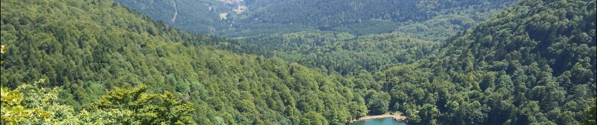
La montée au sommet de la Tête des Perches offre une vue magnifique sur le lac.