


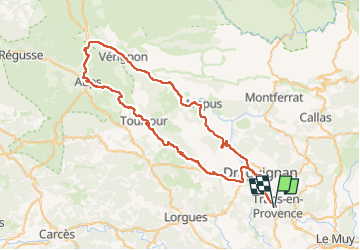
Aups verignon

HENRY83
User

Length
77 km

Max alt
861 m

Uphill gradient
1291 m
Km-Effort
94 km

Min alt
151 m

Downhill gradient
1288 m
Boucle
Yes
Creation date :
2025-06-16 05:37:32.398
Updated on :
2025-06-19 09:54:47.788
3h51
Difficulty : Difficult

FREE GPS app for hiking
 SityTrail
IGN / Geographical institutes
SityTrail Plus
The world is yours!
About
Trail Road bike of 77 km to be discovered at Provence-Alpes-Côte d'Azur, Var, Trans-en-Provence. This trail is proposed by HENRY83.
Description
1200m dénivelé. 70kms.
Positioning
Country:
France
Region :
Provence-Alpes-Côte d'Azur
Department/Province :
Var
Municipality :
Trans-en-Provence
Location:
Unknown
Start:(Dec)
Start:(UTM)
296413 ; 4819665 (32T) N.
Comments