


Etape3

jaoueljnm
User
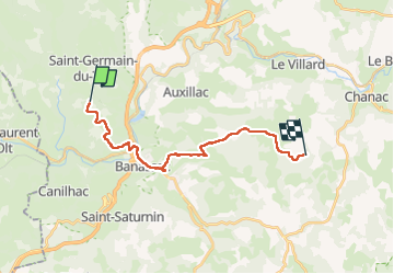

Length
19.9 km

Max alt
889 m

Uphill gradient
522 m
Km-Effort
27 km

Min alt
523 m

Downhill gradient
517 m
Boucle
No
Creation date :
2025-06-19 07:13:16.0
Updated on :
2025-06-19 15:39:23.08

FREE GPS app for hiking
 SityTrail
IGN / Geographical institutes
SityTrail Plus
The world is yours!
About
Trail of 19.9 km to be discovered at Occitania, Lozère, Saint-Germain-du-Teil. This trail is proposed by jaoueljnm.
Positioning
Country:
France
Region :
Occitania
Department/Province :
Lozère
Municipality :
Saint-Germain-du-Teil
Location:
Unknown
Start:(Dec)
Start:(UTM)
513411 ; 4923356 (31T) N.
Comments