


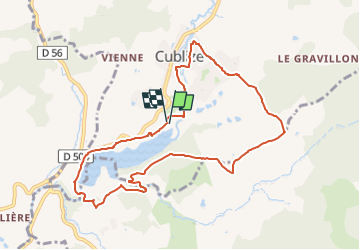
Cublize

Pierre Burthier
User

Length
9.5 km

Max alt
611 m

Uphill gradient
282 m
Km-Effort
13.2 km

Min alt
426 m

Downhill gradient
282 m
Boucle
Yes
Creation date :
2025-06-20 09:41:56.775
Updated on :
2025-06-20 09:45:46.322
3h00
Difficulty : Difficult

FREE GPS app for hiking
 SityTrail
IGN / Geographical institutes
SityTrail Plus
The world is yours!
About
Trail Walking of 9.5 km to be discovered at Auvergne-Rhône-Alpes, Rhône, Cublize. This trail is proposed by Pierre Burthier.
Description
9,5 km
Positioning
Country:
France
Region :
Auvergne-Rhône-Alpes
Department/Province :
Rhône
Municipality :
Cublize
Location:
Unknown
Start:(Dec)
Start:(UTM)
606621 ; 5096191 (31T) N.
Comments