


2025-06-20 Le Puy de la Vache

Nordic33
User GUIDE
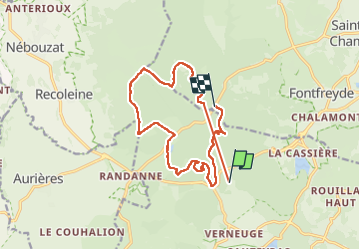

Length
16.3 km

Max alt
1174 m

Uphill gradient
549 m
Km-Effort
23 km

Min alt
902 m

Downhill gradient
471 m
Boucle
No
Creation date :
2025-06-20 07:44:53.358
Updated on :
2025-06-24 17:56:49.297
5h34
Difficulty : Very difficult

FREE GPS app for hiking
 SityTrail
IGN / Geographical institutes
SityTrail Plus
The world is yours!
About
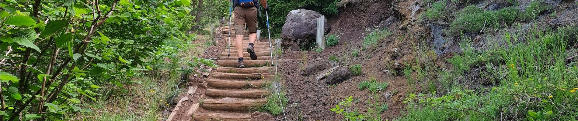
Trail Walking of 16.3 km to be discovered at Auvergne-Rhône-Alpes, Puy-de-Dôme, Aydat. This trail is proposed by Nordic33.
Photos


Positioning
Country:
France
Region :
Auvergne-Rhône-Alpes
Department/Province :
Puy-de-Dôme
Municipality :
Aydat
Location:
Unknown
Start:(Dec)
Start:(UTM)
497838 ; 5058850 (31T) N.
Comments