


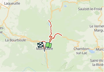
cols: croix Morand, guery

GuySimonin
User

Length
26 km

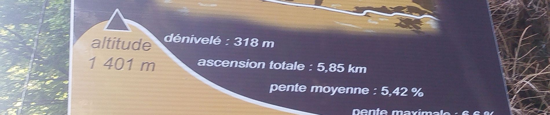
Max alt
1402 m

Uphill gradient
555 m
Km-Effort
33 km

Min alt
1038 m

Downhill gradient
559 m
Boucle
Yes
Creation date :
2025-06-20 15:52:56.587
Updated on :
2025-06-20 17:28:48.16
1h20
Difficulty : Difficult

FREE GPS app for hiking
 SityTrail
IGN / Geographical institutes
SityTrail Plus
The world is yours!
About
Trail Road bike of 26 km to be discovered at Auvergne-Rhône-Alpes, Puy-de-Dôme, Mont-Dore. This trail is proposed by GuySimonin.
Photos


Positioning
Country:
France
Region :
Auvergne-Rhône-Alpes
Department/Province :
Puy-de-Dôme
Municipality :
Mont-Dore
Location:
Unknown
Start:(Dec)
Start:(UTM)
485152 ; 5046309 (31T) N.
Comments