


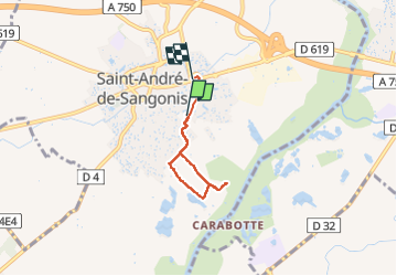
Saint-André-de-Sangonis

Evelyne3
User

Length
4.1 km

Max alt
69 m

Uphill gradient
34 m
Km-Effort
4.5 km

Min alt
41 m

Downhill gradient
29 m
Boucle
No
Creation date :
2025-06-21 07:48:03.009
Updated on :
2025-06-21 10:00:54.516
55m
Difficulty : Easy

FREE GPS app for hiking
 SityTrail
IGN / Geographical institutes
SityTrail Plus
The world is yours!
About
Trail Walking of 4.1 km to be discovered at Occitania, Hérault, Saint-André-de-Sangonis. This trail is proposed by Evelyne3.
Description
jolie balade avec les gueppiers d'europe
Positioning
Country:
France
Region :
Occitania
Department/Province :
Hérault
Municipality :
Saint-André-de-Sangonis
Location:
Unknown
Start:(Dec)
Start:(UTM)
541069 ; 4832777 (31T) N.
Comments