


Villé - vierge noire - château Honcourt - la grotte

Bart2015
User
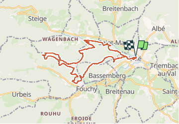

Length
18 km

Max alt
614 m

Uphill gradient
668 m
Km-Effort
27 km

Min alt
263 m

Downhill gradient
668 m
Boucle
Yes
Creation date :
2025-06-21 06:34:17.605
Updated on :
2025-07-07 16:34:50.266
6h07
Difficulty : Very difficult

FREE GPS app for hiking
 SityTrail
IGN / Geographical institutes
SityTrail Plus
The world is yours!
About
Trail Walking of 18 km to be discovered at Grand Est, Bas-Rhin, Villé. This trail is proposed by Bart2015.
Description
De nombreux endroits sympas pour pique-niquer.
Bonne rando ...
Photos


Positioning
Country:
France
Region :
Grand Est
Department/Province :
Bas-Rhin
Municipality :
Villé
Location:
Unknown
Start:(Dec)
Start:(UTM)
374326 ; 5355888 (32U) N.
Comments