


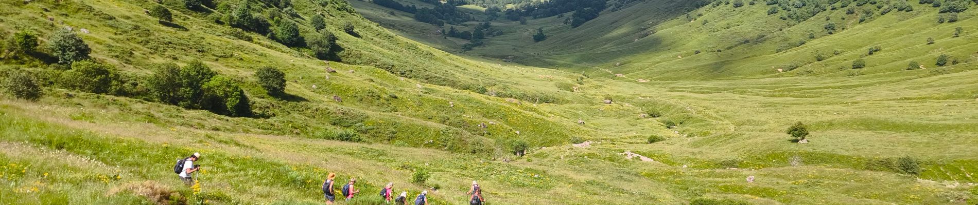
la Gravière/ brèche de Roland Peyre arse

tyntyn
User
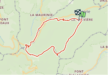

Length
17.1 km

Max alt
1781 m

Uphill gradient
753 m
Km-Effort
27 km

Min alt
1074 m

Downhill gradient
802 m
Boucle
No
Creation date :
2025-06-21 06:47:03.325
Updated on :
2025-06-21 16:03:45.441
9h15
Difficulty : Difficult

FREE GPS app for hiking
 SityTrail
IGN / Geographical institutes
SityTrail Plus
The world is yours!
About
Trail Walking of 17.1 km to be discovered at Auvergne-Rhône-Alpes, Cantal, Lavigerie. This trail is proposed by tyntyn.
Photos


Positioning
Country:
France
Region :
Auvergne-Rhône-Alpes
Department/Province :
Cantal
Municipality :
Lavigerie
Location:
Unknown
Start:(Dec)
Start:(UTM)
479591 ; 4997519 (31T) N.
Comments