


2025_06_22_Gd Veymont et Aiguille

Chamois30
User
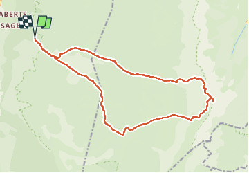

Length
20 km

Max alt
2329 m

Uphill gradient
1074 m
Km-Effort
34 km

Min alt
1359 m

Downhill gradient
1071 m
Boucle
Yes
Creation date :
2025-06-22 06:09:02.712
Updated on :
2025-06-22 20:05:41.7
5h34
Difficulty : Difficult

FREE GPS app for hiking
 SityTrail
IGN / Geographical institutes
SityTrail Plus
The world is yours!
About
Trail Walking of 20 km to be discovered at Auvergne-Rhône-Alpes, Drôme, Saint-Agnan-en-Vercors. This trail is proposed by Chamois30.
Description
Depuis M.F. De la Coche
Positioning
Country:
France
Region :
Auvergne-Rhône-Alpes
Department/Province :
Drôme
Municipality :
Saint-Agnan-en-Vercors
Location:
Unknown
Start:(Dec)
Start:(UTM)
692857 ; 4973238 (31T) N.
Comments