


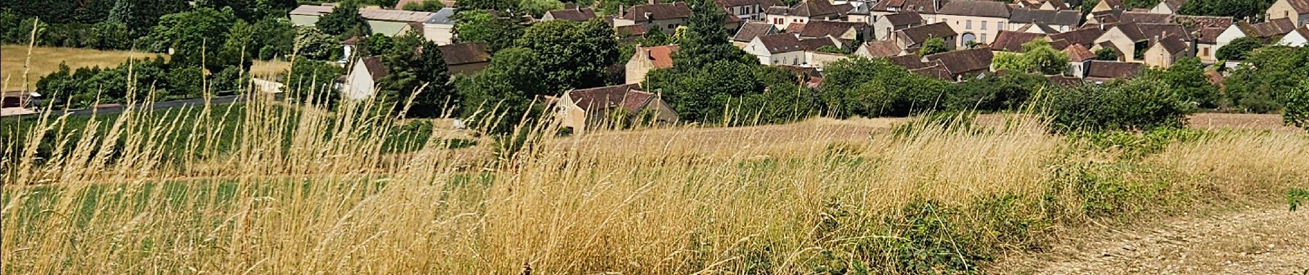
les bordes

Claude Gregoire
User
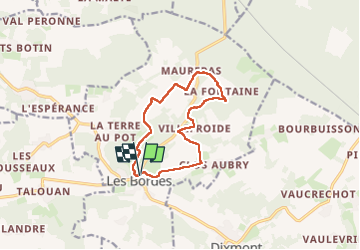

Length
10.6 km

Max alt
213 m

Uphill gradient
213 m
Km-Effort
13.4 km

Min alt
114 m

Downhill gradient
213 m
Boucle
Yes
Creation date :
2025-06-25 06:53:29.648
Updated on :
2025-06-25 10:02:11.466
3h07
Difficulty : Difficult

FREE GPS app for hiking
 SityTrail
IGN / Geographical institutes
SityTrail Plus
The world is yours!
About
Trail Walking of 10.6 km to be discovered at Bourgogne-Franche-Comté, Yonne, Les Bordes. This trail is proposed by Claude Gregoire.
Photos


Positioning
Country:
France
Region :
Bourgogne-Franche-Comté
Department/Province :
Yonne
Municipality :
Les Bordes
Location:
Unknown
Start:(Dec)
Start:(UTM)
528349 ; 5327321 (31U) N.
Comments