


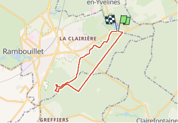
étang de la tour

topophil
User

Length
11.3 km

Max alt
182 m

Uphill gradient
82 m
Km-Effort
12.4 km

Min alt
158 m

Downhill gradient
86 m
Boucle
Yes
Creation date :
2025-06-25 07:41:07.102
Updated on :
2025-06-25 10:43:56.625
3h02
Difficulty : Difficult

FREE GPS app for hiking
 SityTrail
IGN / Geographical institutes
SityTrail Plus
The world is yours!
About
Trail Walking of 11.3 km to be discovered at Ile-de-France, Yvelines, Rambouillet. This trail is proposed by topophil.
Positioning
Country:
France
Region :
Ile-de-France
Department/Province :
Yvelines
Municipality :
Rambouillet
Location:
Unknown
Start:(Dec)
Start:(UTM)
417916 ; 5389638 (31U) N.
Comments