


20250625 Briancon

Childebert
User
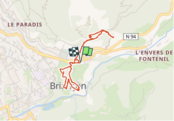

Length
3.9 km

Max alt
1473 m

Uphill gradient
228 m
Km-Effort
7 km

Min alt
1285 m

Downhill gradient
228 m
Boucle
Yes
Creation date :
2025-06-25 09:14:24.975
Updated on :
2025-06-25 11:10:39.272
1h55
Difficulty : Medium

FREE GPS app for hiking
 SityTrail
IGN / Geographical institutes
SityTrail Plus
The world is yours!
About
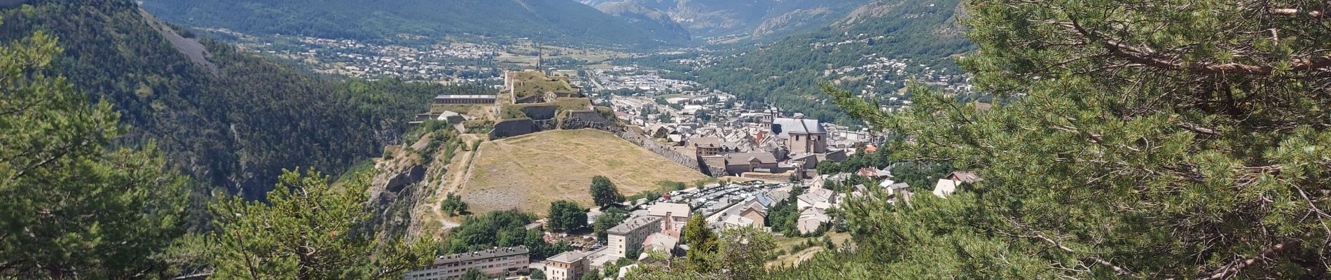
Trail Walking of 3.9 km to be discovered at Provence-Alpes-Côte d'Azur, Hautes-Alpes, Briançon. This trail is proposed by Childebert.
Photos

Positioning
Country:
France
Region :
Provence-Alpes-Côte d'Azur
Department/Province :
Hautes-Alpes
Municipality :
Briançon
Location:
Unknown
Start:(Dec)
Start:(UTM)
314148 ; 4974684 (32T) N.
Comments