


Col Pousterle

jacques.seux
User
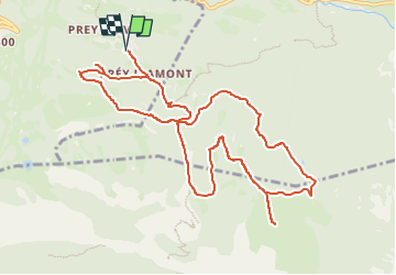

Length
12.2 km

Max alt
2027 m

Uphill gradient
547 m
Km-Effort
19.5 km

Min alt
1552 m

Downhill gradient
550 m
Boucle
Yes
Creation date :
2025-06-25 14:10:45.0
Updated on :
2025-06-25 14:10:46.581

FREE GPS app for hiking
 SityTrail
IGN / Geographical institutes
SityTrail Plus
The world is yours!
About
Trail of 12.2 km to be discovered at Provence-Alpes-Côte d'Azur, Hautes-Alpes, Puy-Saint-Vincent. This trail is proposed by jacques.seux.
Positioning
Country:
France
Region :
Provence-Alpes-Côte d'Azur
Department/Province :
Hautes-Alpes
Municipality :
Puy-Saint-Vincent
Location:
Unknown
Start:(Dec)
Start:(UTM)
302788 ; 4965608 (32T) N.
Comments