


la Routo Barcelonnette/ Condamine

taguette
User
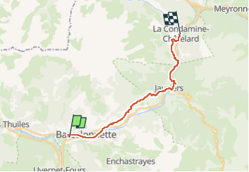

Length
18.7 km

Max alt
1419 m

Uphill gradient
513 m
Km-Effort
25 km

Min alt
1126 m

Downhill gradient
356 m
Boucle
No
Creation date :
2025-06-26 05:39:55.249
Updated on :
2025-06-26 12:32:45.284
6h52
Difficulty : Very difficult

FREE GPS app for hiking
 SityTrail
IGN / Geographical institutes
SityTrail Plus
The world is yours!
About
Trail Walking of 18.7 km to be discovered at Provence-Alpes-Côte d'Azur, Alpes-de-Haute-Provence, Barcelonnette. This trail is proposed by taguette.
Positioning
Country:
France
Region :
Provence-Alpes-Côte d'Azur
Department/Province :
Alpes-de-Haute-Provence
Municipality :
Barcelonnette
Location:
Unknown
Start:(Dec)
Start:(UTM)
311601 ; 4917283 (32T) N.
Comments