


Prapic - Col des Tourettes

frizou83
User
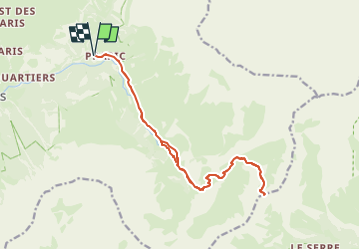

Length
18.5 km

Max alt
2579 m

Uphill gradient
1069 m
Km-Effort
33 km

Min alt
1536 m

Downhill gradient
1070 m
Boucle
Yes
Creation date :
2025-06-27 14:10:24.288
Updated on :
2025-06-27 14:15:24.664
7h26
Difficulty : Very difficult

FREE GPS app for hiking
 SityTrail
IGN / Geographical institutes
SityTrail Plus
The world is yours!
About
Trail Walking of 18.5 km to be discovered at Provence-Alpes-Côte d'Azur, Hautes-Alpes, Orcières. This trail is proposed by frizou83.
Positioning
Country:
France
Region :
Provence-Alpes-Côte d'Azur
Department/Province :
Hautes-Alpes
Municipality :
Orcières
Location:
Unknown
Start:(Dec)
Start:(UTM)
291284 ; 4952242 (32T) N.
Comments