


Contamines Aiguillette des HOUCHES V2

c.gourme
User
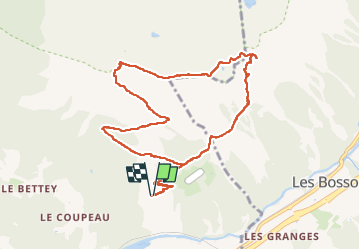

Length
11.1 km

Max alt
2303 m

Uphill gradient
959 m
Km-Effort
24 km

Min alt
1344 m

Downhill gradient
957 m
Boucle
Yes
Creation date :
2025-06-28 07:01:46.0
Updated on :
2025-06-28 14:26:54.714
6h30
Difficulty : Difficult

FREE GPS app for hiking
 SityTrail
IGN / Geographical institutes
SityTrail Plus
The world is yours!
About
Trail Walking of 11.1 km to be discovered at Auvergne-Rhône-Alpes, Upper Savoy, Les Houches. This trail is proposed by c.gourme.
Description
On l’a fait dans l’autre sens et ce chemin est plus facile.
Positioning
Country:
France
Region :
Auvergne-Rhône-Alpes
Department/Province :
Upper Savoy
Municipality :
Les Houches
Location:
Unknown
Start:(Dec)
Start:(UTM)
330226 ; 5085884 (32T) N.
Comments