


20250628 Lac de Souliers

Childebert
User
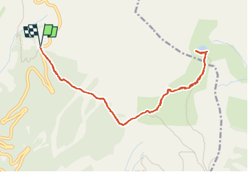

Length
5.5 km

Max alt
2496 m

Uphill gradient
287 m
Km-Effort
9.4 km

Min alt
2203 m

Downhill gradient
287 m
Boucle
Yes
Creation date :
2025-06-28 09:45:29.488
Updated on :
2025-06-28 15:53:48.829
3h42
Difficulty : Difficult

FREE GPS app for hiking
 SityTrail
IGN / Geographical institutes
SityTrail Plus
The world is yours!
About
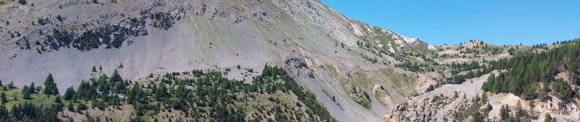
Trail Walking of 5.5 km to be discovered at Provence-Alpes-Côte d'Azur, Hautes-Alpes, Arvieux. This trail is proposed by Childebert.
Photos

Positioning
Country:
France
Region :
Provence-Alpes-Côte d'Azur
Department/Province :
Hautes-Alpes
Municipality :
Arvieux
Location:
Unknown
Start:(Dec)
Start:(UTM)
320974 ; 4964071 (32T) N.
Comments