


Ramieres

collot
User
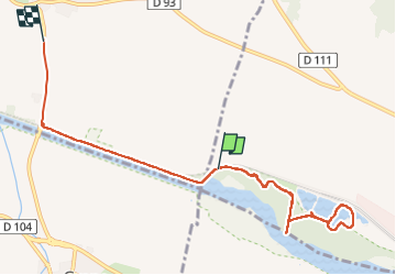

Length
8.9 km

Max alt
163 m

Uphill gradient
45 m
Km-Effort
9.6 km

Min alt
137 m

Downhill gradient
60 m
Boucle
No
Creation date :
2025-06-29 07:27:19.629
Updated on :
2025-06-29 09:49:39.254
2h21
Difficulty : Easy

FREE GPS app for hiking
 SityTrail
IGN / Geographical institutes
SityTrail Plus
The world is yours!
About
Trail Walking of 8.9 km to be discovered at Auvergne-Rhône-Alpes, Drôme, Eurre. This trail is proposed by collot.
Positioning
Country:
France
Region :
Auvergne-Rhône-Alpes
Department/Province :
Drôme
Municipality :
Eurre
Location:
Unknown
Start:(Dec)
Start:(UTM)
654157 ; 4956307 (31T) N.
Comments