


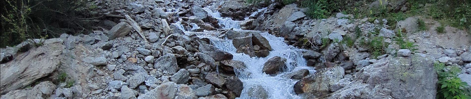
Lacs de Vens et de Fourchas

Noiraude
User
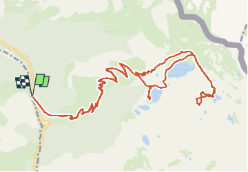

Length
19.2 km

Max alt
2610 m

Uphill gradient
1179 m
Km-Effort
35 km

Min alt
1545 m

Downhill gradient
1176 m
Boucle
Yes
Creation date :
2025-06-29 04:24:51.399
Updated on :
2025-06-29 16:58:01.124
9h41
Difficulty : Medium

FREE GPS app for hiking
 SityTrail
IGN / Geographical institutes
SityTrail Plus
The world is yours!
About
Trail Walking of 19.2 km to be discovered at Provence-Alpes-Côte d'Azur, Maritime Alps, Saint-Étienne-de-Tinée. This trail is proposed by Noiraude.
Photos


Positioning
Country:
France
Region :
Provence-Alpes-Côte d'Azur
Department/Province :
Maritime Alps
Municipality :
Saint-Étienne-de-Tinée
Location:
Unknown
Start:(Dec)
Start:(UTM)
332608 ; 4908499 (32T) N.
Comments