


Luzinay2ouest-15k-10,5d250

christi2057
User
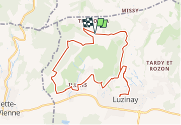

Length
10.6 km

Max alt
335 m

Uphill gradient
275 m
Km-Effort
14.3 km

Min alt
222 m

Downhill gradient
274 m
Boucle
Yes
Creation date :
2025-06-30 14:40:52.965
Updated on :
2025-06-30 14:40:52.965

FREE GPS app for hiking
 SityTrail
IGN / Geographical institutes
SityTrail Plus
The world is yours!
About
Trail of 10.6 km to be discovered at Auvergne-Rhône-Alpes, Isère, Luzinay. This trail is proposed by christi2057.
Positioning
Country:
France
Region :
Auvergne-Rhône-Alpes
Department/Province :
Isère
Municipality :
Luzinay
Location:
Unknown
Start:(Dec)
Start:(UTM)
651714 ; 5051960 (31T) N.
Comments