


3eme jour Arvieux, col du cros

eaea7charles
User
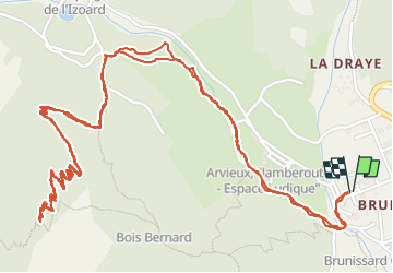

Length
5 km

Max alt
2057 m

Uphill gradient
270 m
Km-Effort
8.6 km

Min alt
1786 m

Downhill gradient
270 m
Boucle
Yes
Creation date :
2025-07-01 06:46:39.331
Updated on :
2025-07-01 09:04:38.219
1h35
Difficulty : Medium

FREE GPS app for hiking
 SityTrail
IGN / Geographical institutes
SityTrail Plus
The world is yours!
About
Trail Walking of 5 km to be discovered at Provence-Alpes-Côte d'Azur, Hautes-Alpes, Arvieux. This trail is proposed by eaea7charles.
Positioning
Country:
France
Region :
Provence-Alpes-Côte d'Azur
Department/Province :
Hautes-Alpes
Municipality :
Arvieux
Location:
Unknown
Start:(Dec)
Start:(UTM)
320235 ; 4962567 (32T) N.
Comments