


col longet

garnier73
User
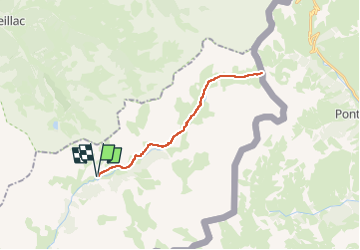

Length
25 km

Max alt
2661 m

Uphill gradient
843 m
Km-Effort
36 km

Min alt
1902 m

Downhill gradient
844 m
Boucle
Yes
Creation date :
2025-07-03 06:38:33.827
Updated on :
2025-07-03 06:38:19.409
2h31
Difficulty : Difficult

FREE GPS app for hiking
 SityTrail
IGN / Geographical institutes
SityTrail Plus
The world is yours!
About
Trail Mountain bike of 25 km to be discovered at Provence-Alpes-Côte d'Azur, Alpes-de-Haute-Provence, Saint-Paul-sur-Ubaye. This trail is proposed by garnier73.
Positioning
Country:
France
Region :
Provence-Alpes-Côte d'Azur
Department/Province :
Alpes-de-Haute-Provence
Municipality :
Saint-Paul-sur-Ubaye
Location:
Unknown
Start:(Dec)
Start:(UTM)
328578 ; 4939875 (32T) N.
Comments