


Col de la Samblue - crêtes de la Laisse

rolland-a
User
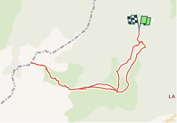

Length
10.3 km

Max alt
2095 m

Uphill gradient
679 m
Km-Effort
19.3 km

Min alt
1480 m

Downhill gradient
677 m
Boucle
Yes
Creation date :
2025-07-03 22:01:29.039
Updated on :
2025-07-03 22:07:09.679
4h23
Difficulty : Very difficult

FREE GPS app for hiking
 SityTrail
IGN / Geographical institutes
SityTrail Plus
The world is yours!
About
Trail Walking of 10.3 km to be discovered at Auvergne-Rhône-Alpes, Isère, Pellafol. This trail is proposed by rolland-a.
Positioning
Country:
France
Region :
Auvergne-Rhône-Alpes
Department/Province :
Isère
Municipality :
Pellafol
Location:
Unknown
Start:(Dec)
Start:(UTM)
728152 ; 4963810 (31T) N.
Comments