


Bisous J 1

jacques.seux
User
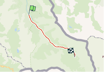

Length
7.2 km

Max alt
2471 m

Uphill gradient
676 m
Km-Effort
14 km

Min alt
1796 m

Downhill gradient
10 m
Boucle
No
Creation date :
2025-07-04 12:29:51.0
Updated on :
2025-07-04 12:29:52.52

FREE GPS app for hiking
 SityTrail
IGN / Geographical institutes
SityTrail Plus
The world is yours!
About
Trail of 7.2 km to be discovered at Provence-Alpes-Côte d'Azur, Hautes-Alpes, Abriès-Ristolas. This trail is proposed by jacques.seux.
Positioning
Country:
France
Region :
Provence-Alpes-Côte d'Azur
Department/Province :
Hautes-Alpes
Municipality :
Abriès-Ristolas
Location:
Ristolas
Start:(Dec)
Start:(UTM)
341397 ; 4955590 (32T) N.
Comments