


Tour de Mont Ferant depuis Roya

Noiraude
User
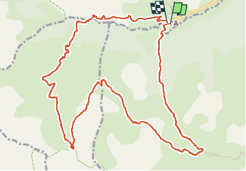

Length
15.2 km

Max alt
2202 m

Uphill gradient
853 m
Km-Effort
27 km

Min alt
1468 m

Downhill gradient
843 m
Boucle
Yes
Creation date :
2025-07-03 04:18:50.877
Updated on :
2025-07-05 05:35:06.491
6h55
Difficulty : Medium

FREE GPS app for hiking
 SityTrail
IGN / Geographical institutes
SityTrail Plus
The world is yours!
About
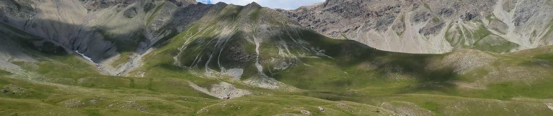
Trail Walking of 15.2 km to be discovered at Provence-Alpes-Côte d'Azur, Maritime Alps, Saint-Étienne-de-Tinée. This trail is proposed by Noiraude.
Photos


Positioning
Country:
France
Region :
Provence-Alpes-Côte d'Azur
Department/Province :
Maritime Alps
Municipality :
Saint-Étienne-de-Tinée
Location:
Unknown
Start:(Dec)
Start:(UTM)
334524 ; 4894972 (32T) N.
Comments