


perdido

tosan
User
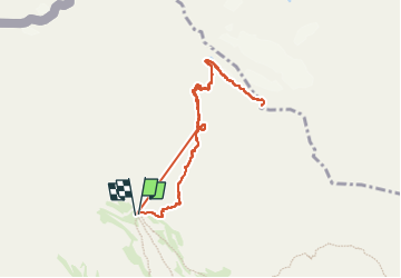

Length
8.6 km

Max alt
3317 m

Uphill gradient
1114 m
Km-Effort
23 km

Min alt
2191 m

Downhill gradient
1118 m
Boucle
Yes
Creation date :
2025-07-03 05:28:53.24
Updated on :
2025-07-05 14:44:36.284
3h35
Difficulty : Very difficult

FREE GPS app for hiking
 SityTrail
IGN / Geographical institutes
SityTrail Plus
The world is yours!
About
Trail Walking of 8.6 km to be discovered at Aragon, Huesca, Fanlo. This trail is proposed by tosan.
Positioning
Country:
Spain
Region :
Aragon
Department/Province :
Huesca
Municipality :
Fanlo
Location:
Unknown
Start:(Dec)
Start:(UTM)
255391 ; 4727748 (31T) N.
Comments