


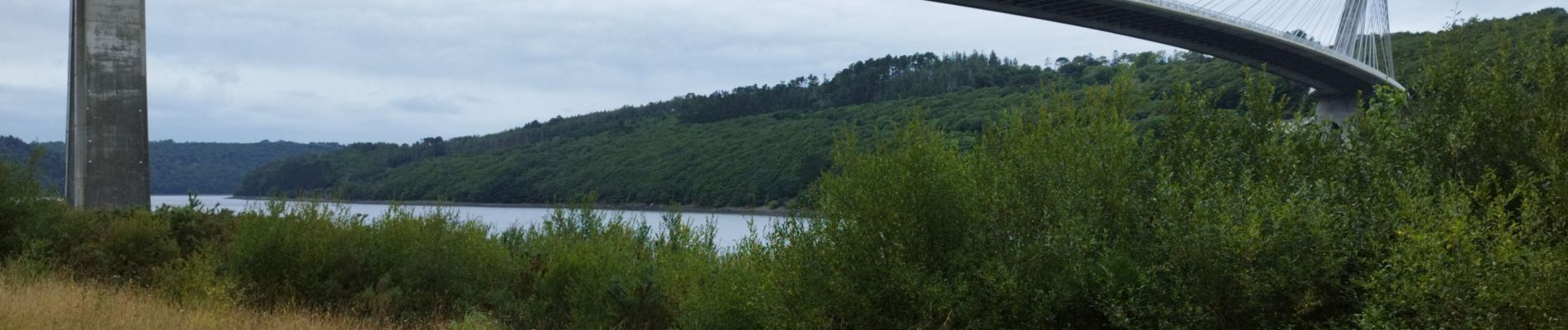
Moulin mer Le Marros Pont de Terenez

jmrobin
User
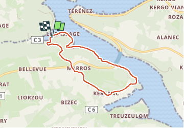

Length
6.5 km

Max alt
89 m

Uphill gradient
134 m
Km-Effort
8.3 km

Min alt
0 m

Downhill gradient
136 m
Boucle
Yes
Creation date :
2025-07-05 13:39:44.495
Updated on :
2025-07-05 15:21:59.134
1h41
Difficulty : Medium

FREE GPS app for hiking
 SityTrail
IGN / Geographical institutes
SityTrail Plus
The world is yours!
About
Trail Walking of 6.5 km to be discovered at Brittany, Finistère, Argol. This trail is proposed by jmrobin.
Photos


Positioning
Country:
France
Region :
Brittany
Department/Province :
Finistère
Municipality :
Argol
Location:
Unknown
Start:(Dec)
Start:(UTM)
404620 ; 5347547 (30U) N.
Comments