


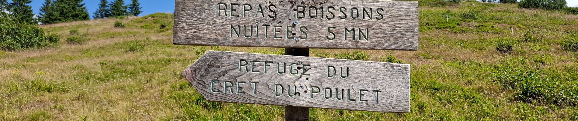
LE CRET DU POULET

walrou63
User
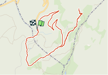

Length
6.9 km

Max alt
1721 m

Uphill gradient
290 m
Km-Effort
10.7 km

Min alt
1426 m

Downhill gradient
286 m
Boucle
Yes
Creation date :
2025-07-05 13:22:21.094
Updated on :
2025-07-05 16:21:17.096
2h58
Difficulty : Medium

FREE GPS app for hiking
 SityTrail
IGN / Geographical institutes
SityTrail Plus
The world is yours!
About
Trail Walking of 6.9 km to be discovered at Auvergne-Rhône-Alpes, Isère, Crêts-en-Belledonne. This trail is proposed by walrou63.
Photos


Positioning
Country:
France
Region :
Auvergne-Rhône-Alpes
Department/Province :
Isère
Municipality :
Crêts-en-Belledonne
Location:
Saint-Pierre-d'Allevard
Start:(Dec)
Start:(UTM)
268572 ; 5023362 (32T) N.
Comments