


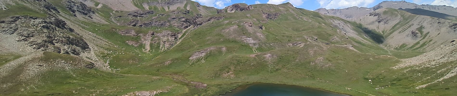
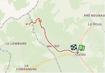
Lacs de Malrif depuis Abries

Noiraude
User

Length
18.9 km

Max alt
2693 m

Uphill gradient
1200 m
Km-Effort
35 km

Min alt
1551 m

Downhill gradient
1192 m
Boucle
Yes
Creation date :
2025-07-05 07:18:17.77
Updated on :
2025-07-05 16:43:40.193
7h54
Difficulty : Difficult

FREE GPS app for hiking
 SityTrail
IGN / Geographical institutes
SityTrail Plus
The world is yours!
About
Trail Walking of 18.9 km to be discovered at Provence-Alpes-Côte d'Azur, Hautes-Alpes, Abriès-Ristolas. This trail is proposed by Noiraude.
Photos


Positioning
Country:
France
Region :
Provence-Alpes-Côte d'Azur
Department/Province :
Hautes-Alpes
Municipality :
Abriès-Ristolas
Location:
Unknown
Start:(Dec)
Start:(UTM)
335863 ; 4962159 (32T) N.
Comments