


Chatelais

jcschubnel
User
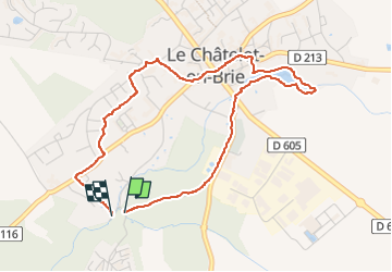

Length
4.2 km

Max alt
93 m

Uphill gradient
35 m
Km-Effort
4.7 km

Min alt
67 m

Downhill gradient
44 m
Boucle
Yes
Creation date :
2025-05-24 14:01:07.534
Updated on :
2025-07-07 15:29:53.496
1h07
Difficulty : Easy

FREE GPS app for hiking
 SityTrail
IGN / Geographical institutes
SityTrail Plus
The world is yours!
About
Trail Walking of 4.2 km to be discovered at Ile-de-France, Seine-et-Marne, Le Châtelet-en-Brie. This trail is proposed by jcschubnel.
Positioning
Country:
France
Region :
Ile-de-France
Department/Province :
Seine-et-Marne
Municipality :
Le Châtelet-en-Brie
Location:
Unknown
Start:(Dec)
Start:(UTM)
484170 ; 5371533 (31U) N.
Comments