


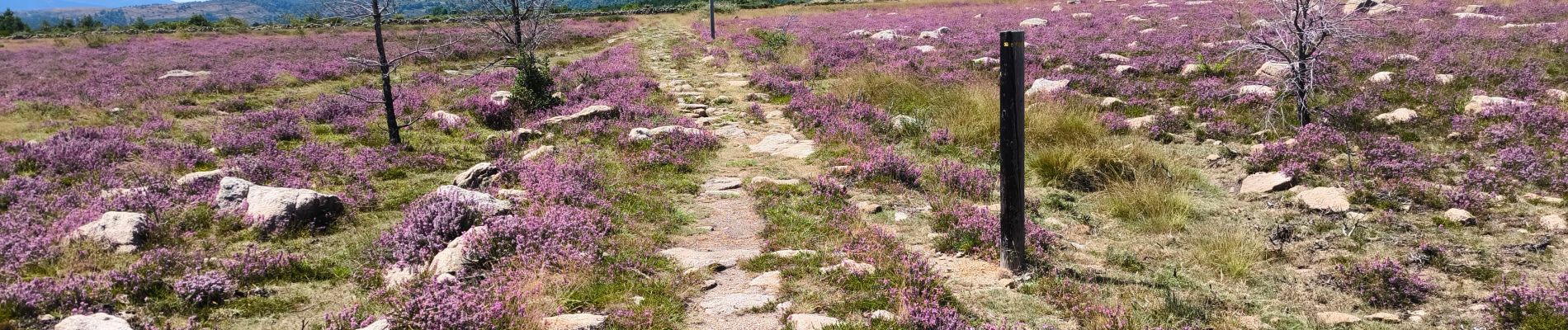
la gare de Guérin gorges du Chassezac

tyntyn
User
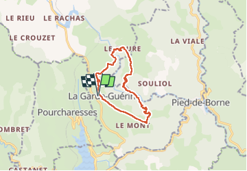

Length
12.3 km

Max alt
874 m

Uphill gradient
586 m
Km-Effort
20 km

Min alt
480 m

Downhill gradient
585 m
Boucle
Yes
Creation date :
2025-07-08 07:03:38.802
Updated on :
2025-07-08 13:59:03.589
6h54
Difficulty : Medium

FREE GPS app for hiking
 SityTrail
IGN / Geographical institutes
SityTrail Plus
The world is yours!
About
Trail Walking of 12.3 km to be discovered at Occitania, Lozère, Prévenchères. This trail is proposed by tyntyn.
Photos


Positioning
Country:
France
Region :
Occitania
Department/Province :
Lozère
Municipality :
Prévenchères
Location:
Unknown
Start:(Dec)
Start:(UTM)
574244 ; 4925357 (31T) N.
Comments