


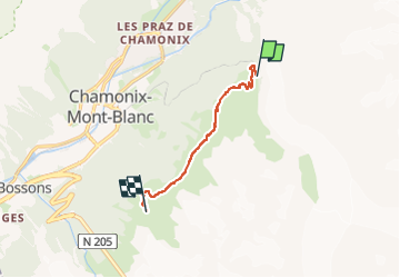
Plan de l'aiguille par Montenvers

Bruno Devigne
User

Length
6.8 km

Max alt
2290 m

Uphill gradient
558 m
Km-Effort
12.9 km

Min alt
1884 m

Downhill gradient
172 m
Boucle
No
Creation date :
2025-06-19 11:15:52.888
Updated on :
2025-07-10 09:52:28.242
2h07
Difficulty : Medium

FREE GPS app for hiking
 SityTrail
IGN / Geographical institutes
SityTrail Plus
The world is yours!
About
Trail Walking of 6.8 km to be discovered at Auvergne-Rhône-Alpes, Upper Savoy, Chamonix-Mont-Blanc. This trail is proposed by Bruno Devigne.
Description
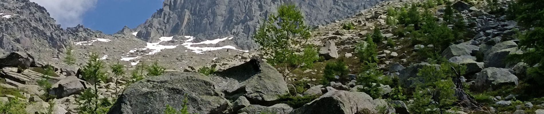
départ du haut du petit train jusqu'à la télécabine
Photos

Positioning
Country:
France
Region :
Auvergne-Rhône-Alpes
Department/Province :
Upper Savoy
Municipality :
Chamonix-Mont-Blanc
Location:
Unknown
Start:(Dec)
Start:(UTM)
338597 ; 5088507 (32T) N.
Comments