


Tour du Valdonnez au départ de Mende

tyntyn
User
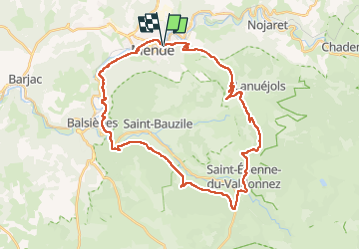

Length
38 km

Max alt
1055 m

Uphill gradient
1058 m
Km-Effort
52 km

Min alt
697 m

Downhill gradient
1057 m
Boucle
Yes
Creation date :
2025-07-10 06:56:07.691
Updated on :
2025-07-10 10:50:45.324
3h54
Difficulty : Very difficult

FREE GPS app for hiking
 SityTrail
IGN / Geographical institutes
SityTrail Plus
The world is yours!
About
Trail Mountain bike of 38 km to be discovered at Occitania, Lozère, Mende. This trail is proposed by tyntyn.
Positioning
Country:
France
Region :
Occitania
Department/Province :
Lozère
Municipality :
Mende
Location:
Unknown
Start:(Dec)
Start:(UTM)
540277 ; 4929731 (31T) N.
Comments