


VERNAY 69

aupi
User
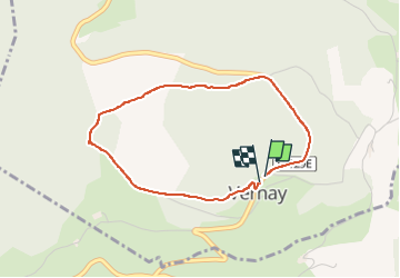

Length
3.4 km

Max alt
744 m

Uphill gradient
75 m
Km-Effort
4.4 km

Min alt
676 m

Downhill gradient
83 m
Boucle
Yes
Creation date :
2025-07-10 12:30:05.725
Updated on :
2025-07-10 14:02:04.319
1h30
Difficulty : Very easy

FREE GPS app for hiking
 SityTrail
IGN / Geographical institutes
SityTrail Plus
The world is yours!
About
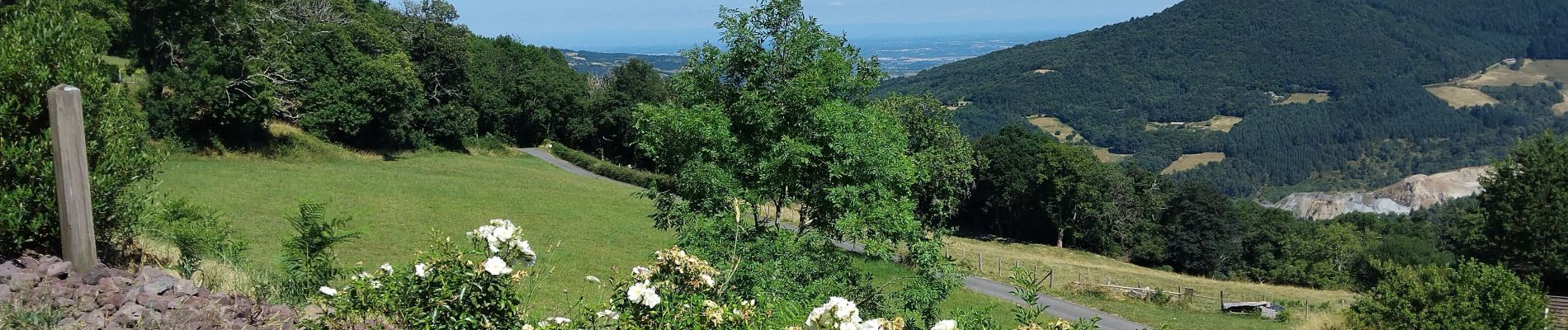
Trail Walking of 3.4 km to be discovered at Auvergne-Rhône-Alpes, Rhône, Vernay. This trail is proposed by aupi.
Photos


Positioning
Country:
France
Region :
Auvergne-Rhône-Alpes
Department/Province :
Rhône
Municipality :
Vernay
Location:
Unknown
Start:(Dec)
Start:(UTM)
618133 ; 5112759 (31T) N.
Comments